
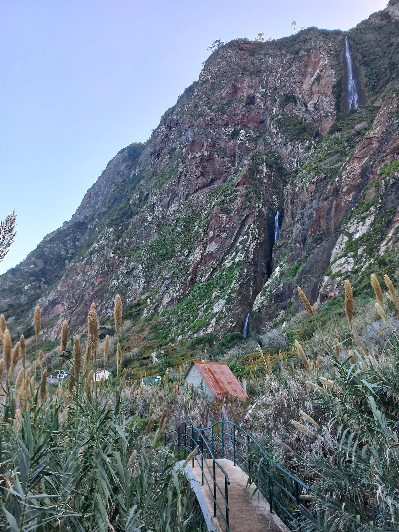
V-NAVIO (Vereda da Rocha do Navio) is a 1.6 km each way (3.2 km round trip), medium, community route. Cost: free. Whether it is worth hiking right now depends on live conditions and today's official status, re-checked every 20 minutes in the live app.
Madeira
A forecast for the nearest town is not a forecast for this path. That is what the live score is for. How the island splits one forecast into many: microclimate guide.
Go or wait today?
You have already picked the walk. The pass answers the one question left, whether today is the morning worth the drive: it reads the live weather on the trail and gives you one honest answer, re-checked every 20 minutes.
Ten seconds, one tap, from €2.99 once. No subscription.
Download GPX: free offline map
Grab the full GPS track and waypoints for Vereda da Rocha do Navio as a free GPX file, no signup. Load it into Garmin, Komoot, AllTrails, Gaia GPS or OsmAnd and follow the route offline, even where there is no phone signal.
ⓘ Source & safety
Track and waypoints from OpenStreetMap contributors (ODbL). Planning aid, not a safety guarantee. Check the official trail status and conditions before you go.Estimated hiking time
53min
About Vereda da Rocha do Navio
A short but steep coastal vereda on Madeira's north coast at Santana that drops down the cliff face to the Fajã da Rocha do Navio, a flat strip of farmland by the sea inside a nature reserve. The descent runs on stone stairs and switchbacks losing a few hundred metres of height to reach the shore, with waterfalls and open ocean views along the way that are strongest after rain. A cable car serves the same route for those who want to skip the climb back up.
Vereda da Rocha do Navio (V-NAVIO) is a round trip route of about 3.2 km in Madeira.
What you'll see
The route takes in coastal cliffs and ocean views, waterfalls, panoramic viewpoints and exposed, drop-side sections.
Landmarks on the route include Rocha do Navio.
The path runs between roughly 0 m and 329 m above sea level, so conditions can change with altitude.
Difficulty
Vereda da Rocha do Navio rates as medium on our objective scale, based on 3.2 km round trip and 341 m of ascent.
This grade is an estimate from distance, ascent and exposure, not an official IFCN rating.
How long it takes
Allow about 2h for the round trip (you return the same way).
The app's live 0-100 score also flags the latest safe start time for the day. See it in the app.
Getting there and back
Starts at Santana cliff top. Ends at Fajã da Rocha do Navio. The car park at the start has room for about 3.
What to bring
2 drinking-water points are mapped along the route. Fill up where you can, but carry enough to finish without them.
Best time to walk it
Year-round, but avoid wet days (slippery, eroded steps)
Coastal walks are often at their best in soft late-afternoon light.
Most of this route sits in shade, which keeps it walkable on days when open ground is punishing.
The sun and shade reading comes from the slope's aspect and steepness, so it describes terrain shading and not tree cover.
A live 0-100 score picks the best 30-minute window for the day. See today's window in the app.
Frequently asked questions
Is Vereda da Rocha do Navio worth hiking today?
It depends on today's conditions, and that is exactly what Levadas answers. The app reads the current weather at Vereda da Rocha do Navio, the safe-start window, how busy it is and the official IFCN status, then gives one honest go-or-wait score from 0 to 100, re-checked every 20 minutes. It is decision-support, not a safety clearance: an official IFCN closure always overrides the score, no matter how good the weather looks.
How long is Vereda da Rocha do Navio?
Vereda da Rocha do Navio is about 3.2 km round trip.
How difficult is Vereda da Rocha do Navio?
Vereda da Rocha do Navio rates as medium based on its distance, ascent and exposure (an objective estimate, not an official IFCN grade).
How long does Vereda da Rocha do Navio take to walk?
Allow about 2h for the round trip.
Can I download a GPX track for Vereda da Rocha do Navio?
Yes. Tap Download GPX on this page: the first download on any device asks for an email so we can also send the free trail pack, then every later trail downloads instantly.
Is Vereda da Rocha do Navio free to walk?
Yes. Vereda da Rocha do Navio needs no reservation and has no fee. Only the regulated official PR trails require a paid SIMplifica booking; this one you simply walk.
Where does Vereda da Rocha do Navio start and finish?
Vereda da Rocha do Navio starts at Santana cliff top and finishes at Fajã da Rocha do Navio.
What will I see on Vereda da Rocha do Navio?
Highlights include coastal cliffs and ocean views, waterfalls, panoramic viewpoints and exposed, drop-side sections.
When is the best time to hike Vereda da Rocha do Navio?
Year-round, but avoid wet days (slippery, eroded steps)
How do I check live conditions for Vereda da Rocha do Navio?
Levadas scores Vereda da Rocha do Navio from 0 to 100 using live weather along the path and the official status, refreshed every 20 minutes. You also see how busy it is. Open the trail in the app to see the live score and the best time to go today.